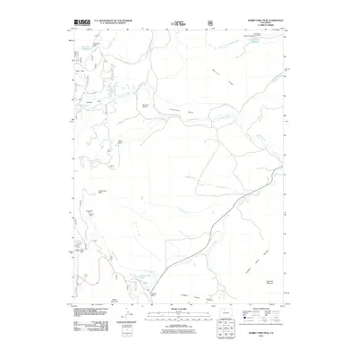
2011 Map of Rabbit Ears Peak
USGS Topo · Published 2011About this map
The high-altitude landscape of the Rabbit Ears Range dominates this 2011 survey, centered on the unmistakable formation of Rabbit Ears Peak. The map highlights a network of water resources vital to the region, including the Bear Park Reservoir and McGowan Reservoir, alongside the headwaters of Grizzly Creek and Colorado Creek. The presence of the McGowan Homestead in the northeast corner provides a rare point of historical settlement within the complex terrain, while the Black Bunny Mine and Bonanza Mine northwest of the peak point to a legacy of mineral exploration in the area.
Find a feature on this map
35 named features on this map. Tap any name to fly to it.
Don’t see what you’re looking for? This feature index may not catch every label — zoom into the map to look around manually.
Map Details
Editions of this 2011 Rabbit Ears Peak Map
This is the sole edition of this map. No revisions or reprints were ever made.
Other maps of this area

1911 · Hahns Peak
USGS Topo · 1:125,000

1913 · Hahns Peak
USGS Topo · 1:125,000

1954 · Craig
USGS Topo · 1:250,000

1955 · Buffalo Pass
USGS Topo · 1:24,000

1955 · Teal Lake
USGS Topo · 1:24,000

1955 · Coalmont
USGS Topo · 1:24,000

1955 · Mount Ethel
USGS Topo · 1:62,500

1955 · Walden
USGS Topo · 1:62,500

1956 · Rabbit Ears Peak
USGS Topo · 1:24,000

1956 · Lake Agnes
USGS Topo · 1:24,000