
1956 Map of Rabbit Ears Peak
USGS Topo · Published 1958About this map
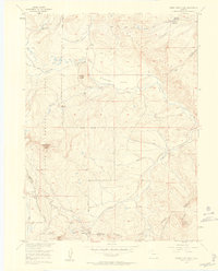
The Continental Divide winds through this high-altitude landscape, defining the watershed between the Routt National Forest and Arapaho National Forest. The prominent volcanic formation of Rabbit Ears Peak overlooks the vital mountain passage at Rabbit Ears Pass, which serves as a primary link between the western slope and the high parks. This 1950s survey documents the infrastructure of a working wilderness, from the McGowan Homestead in the northeast to a Lumber Camp near Cloverleaf Valley. Water management is evident through the presence of the Ross Ditch and several reservoirs like Bear Park Reservoir, supporting high-country agriculture and forestry. The terrain is crisscrossed by established routes such as the Helena Trail and the Lake Trail, alongside several unnamed jeep trails that indicate mid-century resource access.
Find a feature on this map
38 named features on this map. Tap any name to fly to it.
Don’t see what you’re looking for? This feature index may not catch every label — zoom into the map to look around manually.
Map Details
Editions of this 1956 Rabbit Ears Peak Map
4 editions found
Other maps of this area

1911 · Hahns Peak
USGS Topo · 1:125,000

1913 · Hahns Peak
USGS Topo · 1:125,000

1954 · Craig
USGS Topo · 1:250,000

1955 · Buffalo Pass
USGS Topo · 1:24,000

1955 · Teal Lake
USGS Topo · 1:24,000

1955 · Coalmont
USGS Topo · 1:24,000

1955 · Mount Ethel
USGS Topo · 1:62,500

1955 · Walden
USGS Topo · 1:62,500

1956 · Lake Agnes
USGS Topo · 1:24,000

1956 · Spicer Peak
USGS Topo · 1:24,000