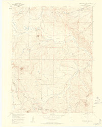
1956 Map of Rabbit Ears Peak
USGS Topo · Published 1958About this map
Continental Divide winds through this high-elevation landscape where Jackson and Grand counties meet, defined by the iconic Rabbit Ears Peak and the surrounding Rabbit Ears Range. During the mid-1950s, this area functioned as a productive landscape of water management and seasonal mountain industry. Traces of human activity are anchored by the McGowan Homestead near the McGowan Reservoir and a Lumber Camp situated in the central timberlands. The hydrological network is well-documented, showing the Crosby Ditch feeding into the Bear Park Reservoir and numerous headwaters like Grizzly Creek and Fancher Creek flowing through the Routt National Forest. High-country landmarks such as the White Slide and Harrison Hump overlook the Cloverleaf Valley, while Muddy Pass marks a critical crossing point for early travelers and surveyors navigating the divide between the Arapaho National Forest and the northern slopes.
Find a feature on this map
34 named features on this map. Tap any name to fly to it.
Don’t see what you’re looking for? This feature index may not catch every label — zoom into the map to look around manually.
Map Details
Editions of this 1956 Rabbit Ears Peak Map
4 editions found
Other maps of this area

1911 · Hahns Peak
USGS Topo · 1:125,000

1913 · Hahns Peak
USGS Topo · 1:125,000

1954 · Craig
USGS Topo · 1:250,000

1955 · Buffalo Pass
USGS Topo · 1:24,000

1955 · Teal Lake
USGS Topo · 1:24,000

1955 · Coalmont
USGS Topo · 1:24,000

1955 · Mount Ethel
USGS Topo · 1:62,500

1955 · Walden
USGS Topo · 1:62,500

1956 · Rabbit Ears Peak
USGS Topo · 1:24,000

1956 · Lake Agnes
USGS Topo · 1:24,000