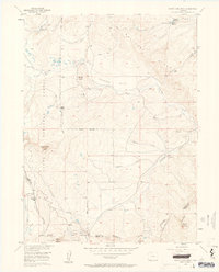
1956 Map of Rabbit Ears Peak
USGS Topo · Published 1964About this map
The high-altitude terrain of the Continental Divide defines this mid-century survey, where the Rabbit Ears Range and Routt National Forest meet. The landscape is marked by extreme topography and historical land use, ranging from the prominent Rabbit Ears Peak and White Slide to high-elevation water sources like Bear Park Reservoir and McGowan Reservoir. The map documents a sparsely settled frontier during the 1950s, characterized by isolated sites such as the McGowan Homestead and a Lumber Camp. These small, localized footprints illustrate the area's legacy of early ranching and timber harvesting. Movement through the peaks is dictated by significant mountain crossings at Rabbit Ears Pass and Muddy Pass, while the branching waters of Grizzly Creek and Colorado Creek drain the surrounding slopes, reflecting the complex hydrology of the Colorado high country.
Find a feature on this map
43 named features on this map. Tap any name to fly to it.
Don’t see what you’re looking for? This feature index may not catch every label — zoom into the map to look around manually.
Map Details
Editions of this 1956 Rabbit Ears Peak Map
4 editions found
Other maps of this area

1911 · Hahns Peak
USGS Topo · 1:125,000

1913 · Hahns Peak
USGS Topo · 1:125,000

1954 · Craig
USGS Topo · 1:250,000

1955 · Buffalo Pass
USGS Topo · 1:24,000

1955 · Teal Lake
USGS Topo · 1:24,000

1955 · Coalmont
USGS Topo · 1:24,000

1955 · Mount Ethel
USGS Topo · 1:62,500

1955 · Walden
USGS Topo · 1:62,500

1956 · Rabbit Ears Peak
USGS Topo · 1:24,000

1956 · Lake Agnes
USGS Topo · 1:24,000