
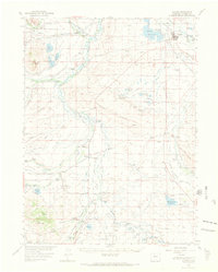
1955 Map of Walden
USGS Topo · Published 1969About this map
The Walden vicinity in the mid-1950s served as a critical ranching and transport hub for North Park, defined by the winding course of the Michigan River and the high-elevation basin floor. The local economy is mapped through a dense network of family-held properties, including the Stellar Grizzly Creek Ranch, Mallon Ranch, and George Allard Ranch, reflecting a landscape of established cattle operations. Transportation is anchored by the Union Pacific railroad corridor, which parallels the river systems and connects the small settlements of Hebron and Coalmont.
Find a feature on this map
109 named features on this map. Tap any name to fly to it.
Don’t see what you’re looking for? This feature index may not catch every label — zoom into the map to look around manually.
Map Details
Editions of this 1955 Walden Map
2 editions found
Other maps of this area

1911 · Hahns Peak
USGS Topo · 1:125,000

1913 · Hahns Peak
USGS Topo · 1:125,000

1954 · Craig
USGS Topo · 1:250,000

1955 · Lake John
USGS Topo · 1:24,000

1955 · Pitchpine Mountain
USGS Topo · 1:24,000

1955 · Eagle Hill
USGS Topo · 1:24,000

1955 · Teal Lake
USGS Topo · 1:24,000

1955 · Delaney Butte
USGS Topo · 1:24,000

1955 · Coalmont
USGS Topo · 1:24,000

1955 · Owl Ridge
USGS Topo · 1:24,000