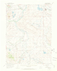
1955 Map of Walden
USGS Topo · Published 1969About this map
Walden serves as the focal point of this northern Colorado high-country survey, situated where the Michigan River meets the plains of North Park. The landscape is defined by an extensive network of irrigation ditches and reservoirs, such as Walden Reservoir and the MacFarlane Reservoir, which supported a ranching economy visible through numerous family-named holdings like the Wattenberg Ranch, Sorenson Ranch, and Allard Ranch. The Union Pacific railroad line cuts through the terrain, connecting the regional hub of Walden with smaller railroad-dependent points like Hebron and Coalmont.
Find a feature on this map
76 named features on this map. Tap any name to fly to it.
Don’t see what you’re looking for? This feature index may not catch every label — zoom into the map to look around manually.
Map Details
Editions of this 1955 Walden Map
2 editions found

Other maps of this area

1911 · Hahns Peak
USGS Topo · 1:125,000

1913 · Hahns Peak
USGS Topo · 1:125,000

1954 · Craig
USGS Topo · 1:250,000

1955 · Lake John
USGS Topo · 1:24,000

1955 · Pitchpine Mountain
USGS Topo · 1:24,000

1955 · Eagle Hill
USGS Topo · 1:24,000

1955 · Teal Lake
USGS Topo · 1:24,000

1955 · Delaney Butte
USGS Topo · 1:24,000

1955 · Coalmont
USGS Topo · 1:24,000

1955 · Owl Ridge
USGS Topo · 1:24,000