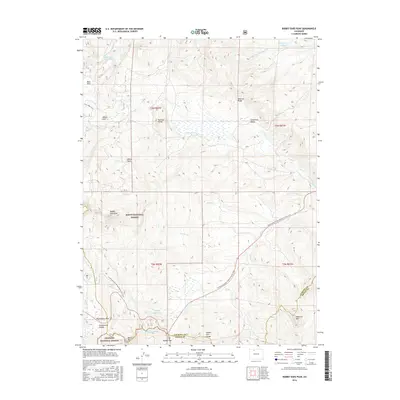
2016 Map of Rabbit Ears Peak
USGS Topo · Published 2016About this map
Rabbit Ears Peak serves as the unmistakable sentinel of this high-country landscape, marking the convergence of the Routt National Forest and the Arapaho National Forest. This 2016 survey traces the high-altitude divide where the Continental Divide National Scenic Trail winds through complex terrain near Rabbit Ears Pass. The map details a critical watershed where the headwaters of Colorado Cr and Grizzly Cr originate, feeding into high-mountain basins like Willow Park and Cloverleaf Valley. The boundary between Jackson and Grand counties bisects the southern reaches, highlighting the transition from the Rabbit Ears Range to individual peaks such as Baker Mtn and Diamond Mtn. For those studying public land use or hydrologic patterns, the inclusion of irrigation and storage features like Ross Ditch Extension and McGowan Reservoir provides insight into how these alpine waters are managed and diverted.
Find a feature on this map
34 named features on this map. Tap any name to fly to it.
Don’t see what you’re looking for? This feature index may not catch every label — zoom into the map to look around manually.
Map Details
Editions of this 2016 Rabbit Ears Peak Map
This is the sole edition of this map. No revisions or reprints were ever made.
Other maps of this area

1911 · Hahns Peak
USGS Topo · 1:125,000

1913 · Hahns Peak
USGS Topo · 1:125,000

1954 · Craig
USGS Topo · 1:250,000

1955 · Buffalo Pass
USGS Topo · 1:24,000

1955 · Teal Lake
USGS Topo · 1:24,000

1955 · Coalmont
USGS Topo · 1:24,000

1955 · Mount Ethel
USGS Topo · 1:62,500

1955 · Walden
USGS Topo · 1:62,500

1956 · Rabbit Ears Peak
USGS Topo · 1:24,000

1956 · Lake Agnes
USGS Topo · 1:24,000