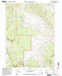
2000 Map of Rabbit Ears Peak
USGS Topo · Published 2004About this map
The Continental Divide winds through this high-altitude landscape of Jackson County, where the Routt and Arapaho National Forests meet. This 2000 revision, based on surveys dating back to the 1950s, documents a rugged terrain defined by significant drainage systems and early mountain settlements. In the northern section of the map, the Mc Gowen Homestead stands as a clear marker of human habitation within this wilderness, situated near the headwaters of several unnamed creeks. The land is marked by the complex transition between various forest administrations and topographic benchmarks that track the shifting elevations of the Colorado high country before the turn of the millennium.
Find a feature on this map
1 named feature on this map. Tap any name to fly to it.
Don’t see what you’re looking for? This feature index may not catch every label — zoom into the map to look around manually.
Map Details
Editions of this 2000 Rabbit Ears Peak Map
This is the sole edition of this map. No revisions or reprints were ever made.
Other maps of this area

1911 · Hahns Peak
USGS Topo · 1:125,000

1913 · Hahns Peak
USGS Topo · 1:125,000

1954 · Craig
USGS Topo · 1:250,000

1955 · Buffalo Pass
USGS Topo · 1:24,000

1955 · Teal Lake
USGS Topo · 1:24,000

1955 · Coalmont
USGS Topo · 1:24,000

1955 · Mount Ethel
USGS Topo · 1:62,500

1955 · Walden
USGS Topo · 1:62,500

1956 · Rabbit Ears Peak
USGS Topo · 1:24,000

1956 · Lake Agnes
USGS Topo · 1:24,000