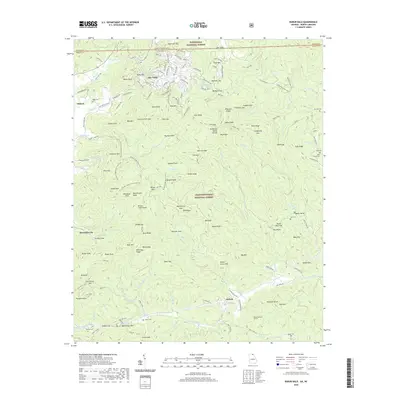
2020 Map of Rabun Bald
USGS Topo · Published 2020About this map
Mountain City and the high-elevation community of Sky Valley anchor this study of the Blue Ridge landscape where Georgia meets North Carolina. The map documents a complex network of ridgeline gaps and peaks, including the prominent Rabun Bald and the Tennessee Valley Divide, which separates the Atlantic and Gulf watersheds. Evidence of early infrastructure and local heritage is preserved through labels like the Black Diamond Tunnel and numerous family burying grounds, such as Green Cem and Kell Cem. The transition from the Nantahala National Forest to the Chattahoochee National Forest marks much of the terrain, while legacy sites like the Locust School and Warwoman Dell provide specific touchpoints for local historians. This 2020 edition detail provides a modern inventory of the roads, trails, and watercourses like Warwoman Cr and Tuckaluge Cr that have defined the region's movement patterns for generations.
Find a feature on this map
159 named features on this map. Tap any name to fly to it.
Don’t see what you’re looking for? This feature index may not catch every label — zoom into the map to look around manually.
Map Details
Editions of this 2020 Rabun Bald Map
This is the sole edition of this map. No revisions or reprints were ever made.
Other maps of this area

1886 · Walhalla
USGS Topo · 1:125,000

1891 · Cowee
USGS Topo · 1:125,000

1892 · Walhalla
USGS Topo · 1:125,000

1896 · Walhalla
USGS Topo · 1:125,000

1897 · Cowee
USGS Topo · 1:125,000

1907 · Cowee
USGS Topo · 1:125,000

1935 · Prentiss
USGS Topo · 1:24,000

1935 · Dillard
USGS Topo · 1:24,000

1935 · Scaly
USGS Topo · 1:24,000

1935 · Rabun Bald
USGS Topo · 1:24,000