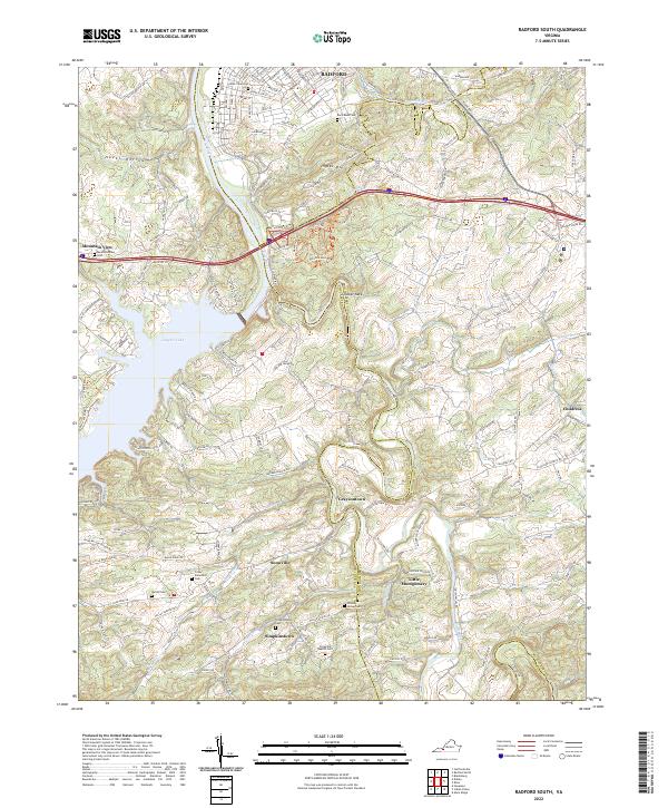
2022 Map of Radford South
USGS Topo · Published 2022About this map
Ingles Mtn rises above the southern edges of Radford, where the New River turns toward the expansive waters of Claytor Lake. This landscape is defined by the winding course of the Little River, which snakes through the countryside past several small settlements including Graysontown, Snowville, and Little Montgomery. The area's history is deeply etched into the land through its numerous burial grounds, such as West View Cem and the Snowville Baptist Cem.
Find a feature on this map
49 named features on this map. Tap any name to fly to it.
Don’t see what you’re looking for? This feature index may not catch every label — zoom into the map to look around manually.
Map Details
Editions of this 2022 Radford South Map
This is the sole edition of this map. No revisions or reprints were ever made.
Other maps of this area

1889 · Hillsville
USGS Topo · 1:125,000

1890 · Dublin
USGS Topo · 1:125,000

1890 · Christiansburg
USGS Topo · 1:125,000

1891 · Dublin
USGS Topo · 1:125,000

1892 · Hillsville
USGS Topo · 1:125,000

1896 · Hillsville
USGS Topo · 1:125,000

1932 · Blacksburg
USGS Topo · 1:48,000

1937 · Blacksburg
USGS Topo · 1:62,500

1950 · Radford
USGS Topo · 1:62,500

1953 · Winston-Salem
USGS Topo · 1:250,000