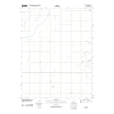
2009 Map of Radium
USGS Topo · Published 2009About this map
The Arkansas River cuts across this section of Stafford County, defining a landscape shaped by both the prairie river system and the extraction of natural resources. Small communities like Radium and Ray anchor the agricultural grid, while the presence of the Radium Townsite Oil Field, Bayer Oil Field, and Dunes North Oil Field indicates the subsurface industry that has long bolstered the local economy.
Find a feature on this map
16 named features on this map. Tap any name to fly to it.
Don’t see what you’re looking for? This feature index may not catch every label — zoom into the map to look around manually.
Map Details
Editions of this 2009 Radium Map
This is the sole edition of this map. No revisions or reprints were ever made.
Other maps of this area

1889 · Larned
USGS Topo · 1:125,000

1891 · Great Bend
USGS Topo · 1:125,000

1891 · Larned
USGS Topo · 1:125,000

1893 · Great Bend
USGS Topo · 1:125,000

1955 · Great Bend
USGS Topo · 1:250,000

1957 · Great Bend
USGS Topo · 1:250,000

1958 · Great Bend
USGS Topo · 1:250,000

1958 · Great Bend
USGS Topo · 1:24,000

1960 · Pawnee Rock
USGS Topo · 1:24,000
1969 · Radium
USGS Topo · 1:24,000