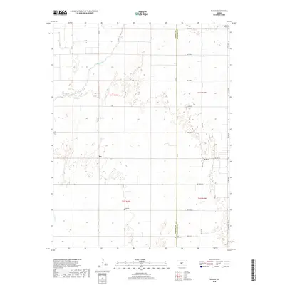
2018 Map of Radium
USGS Topo · Published 2018About this map
Radium and Ray anchor this agricultural landscape in the late 2010s, situated along the county line where Pawnee and Stafford Counties meet. The terrain is defined by the winding course of the Arkansas River in the northwest, accompanied by smaller drainage systems such as Ash Creek and Pickle Creek. This survey captures a highly organized grid of rural roads, including Radium Road and 40th Avenue, which navigate a landscape dotted with numerous small depressions and seasonal wetlands characteristic of the region. Local history is preserved in several rural burial grounds, such as Pleasant Ridge Cemetery in the northeast corner and Fertig Cemetery near the center of the quadrangle. The map illustrates the persistent structure of Kansas section lines and the enduring presence of these small rural communities amidst a primarily agrarian environment.
Find a feature on this map
30 named features on this map. Tap any name to fly to it.
Don’t see what you’re looking for? This feature index may not catch every label — zoom into the map to look around manually.
Map Details
Editions of this 2018 Radium Map
This is the sole edition of this map. No revisions or reprints were ever made.
Other maps of this area

1889 · Larned
USGS Topo · 1:125,000

1891 · Great Bend
USGS Topo · 1:125,000

1891 · Larned
USGS Topo · 1:125,000

1893 · Great Bend
USGS Topo · 1:125,000

1955 · Great Bend
USGS Topo · 1:250,000

1957 · Great Bend
USGS Topo · 1:250,000

1958 · Great Bend
USGS Topo · 1:250,000

1958 · Great Bend
USGS Topo · 1:24,000

1960 · Pawnee Rock
USGS Topo · 1:24,000
1969 · Radium
USGS Topo · 1:24,000