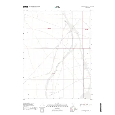
2018 Map of Ragged Top Mountain SW
USGS Topo · Published 2018About this map
Sage Hen Wash cuts through the desert floor of this Pershing County landscape, serving as the primary drainage path through the expansive Granite Springs Valley. The terrain is characterized by broad alluvial basins and isolated valleys, including Copper Valley in the southwest. This 2018 survey reveals a sparse network of infrastructure in an area defined by the Public Land Survey System grids, with Ragged Top Rd providing one of the few named access points through the arid territory. The mapping follows the established township and range lines, such as t26n r27e, which partition the high desert into distinct sections for resource management and land use.
Find a feature on this map
8 named features on this map. Tap any name to fly to it.
Don’t see what you’re looking for? This feature index may not catch every label — zoom into the map to look around manually.
Map Details
Editions of this 2018 Ragged Top Mountain SW Map
This is the sole edition of this map. No revisions or reprints were ever made.
Other maps of this area

1886 · Granite Range
USGS Topo · 1:250,000

1890 · Wadsworth
USGS Topo · 1:125,000

1892 · Wadsworth
USGS Topo · 1:125,000

1894 · Granite Range
USGS Topo · 1:250,000

1894 · Wadsworth
USGS Topo · 1:125,000

1908 · Carson Sink
USGS Topo · 1:250,000

1910 · Carson Sink
USGS Topo · 1:250,000

1931 · Lovelock
USGS Topo · 1:250,000

1935 · Lovelock
USGS Topo · 1:250,000

1951 · Desert Peak
USGS Topo · 1:62,500