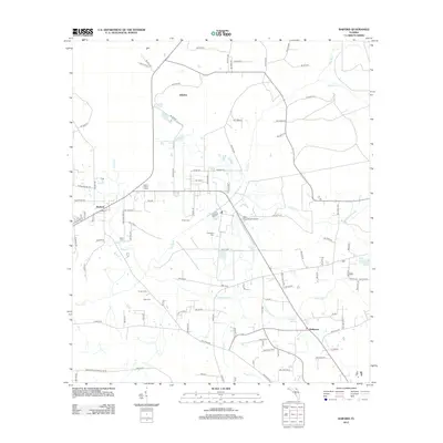
2012 Map of Raiford
USGS Topo · Published 2012About this map
Raiford serves as a focal point for this section of Union County, defined by a landscape where institutional sites and rural settlements meet the winding path of the New River. The area is notably dense with localized history found in small burial grounds such as Sapp Cem, Conner Cem, and Dyal Cem, reflecting the deep familial roots of the surrounding community. To the north and east of the town, the terrain is shaped by the presence of the Prison Cem and the State Prison Field Airport, indicating the long-standing institutional character of the local geography. Natural features like Heilbronn Spring and Water Oak Cr intersect with a grid of rural roads and highways, including Co HWY-229 and Co RD-199. The small clusters of Ellerbee and Heilbronn provide additional points of interest for those studying the settlement patterns of this Florida interior region.
Find a feature on this map
101 named features on this map. Tap any name to fly to it.
Don’t see what you’re looking for? This feature index may not catch every label — zoom into the map to look around manually.
Map Details
Editions of this 2012 Raiford Map
This is the sole edition of this map. No revisions or reprints were ever made.
Other maps of this area

1918 · Lawtey
USGS Topo · 1:62,500

1941 · Starke
USGS Topo · 1:62,500

1948 · Starke
USGS Topo · 1:50,000

1949 · Sampson
USGS Topo · 1:24,000

1949 · Starke
USGS Topo · 1:24,000

1949 · Starke
USGS Topo · 1:62,500

1954 · Gainesville
USGS Topo · 1:250,000

1954 · Valdosta
USGS Topo · 1:250,000

1958 · Valdosta
USGS Topo · 1:250,000

1958 · Gainesville
USGS Topo · 1:250,000