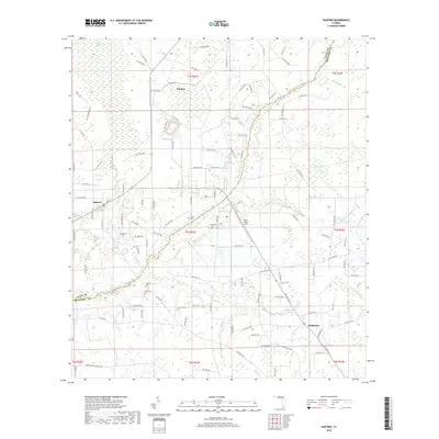
2018 Map of Raiford
USGS Topo · Published 2018About this map
Raiford and the surrounding borderlands of Union and Bradford counties are defined by a complex network of wetlands and institutional land use. The New River meanders through the central terrain, acting as a natural boundary amidst the Turkey Creek Swamp and Cattail Swamp. This landscape is heavily influenced by state landholdings, most notably the State Prison Field, which occupies a significant portion of the quadrangle north of the New River. Genealogy and local history are anchored by several family-named burial grounds, including Sapp Cem, Conner Cem, and Dyal Cem, alongside the Prison Cem. The settlement at Heilbronn in the southeast is punctuated by Heilbronn Spring, while the northern reaches include the community of Ellerbee. To the southwest, the New River Fox Hunt Club indicates the regional importance of traditional field sports within the creek bottoms and pine lands.
Find a feature on this map
111 named features on this map. Tap any name to fly to it.
Don’t see what you’re looking for? This feature index may not catch every label — zoom into the map to look around manually.
Map Details
Editions of this 2018 Raiford Map
This is the sole edition of this map. No revisions or reprints were ever made.
Other maps of this area

1918 · Lawtey
USGS Topo · 1:62,500

1941 · Starke
USGS Topo · 1:62,500

1948 · Starke
USGS Topo · 1:50,000

1949 · Sampson
USGS Topo · 1:24,000

1949 · Starke
USGS Topo · 1:24,000

1949 · Starke
USGS Topo · 1:62,500

1954 · Gainesville
USGS Topo · 1:250,000

1954 · Valdosta
USGS Topo · 1:250,000

1958 · Valdosta
USGS Topo · 1:250,000

1958 · Gainesville
USGS Topo · 1:250,000