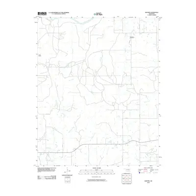
2010 Map of Raiford
USGS Topo · Published 2010About this map
North Canadian River flows across the northern reaches of this McIntosh County landscape, anchoring a complex drainage network that defines the local geography. Numerous named tributaries, including Limbo Creek, Piney Creek, and Gar Creek, carve through the terrain, illustrating the hydrologic character of the Oklahoma plains before they reach the larger river system. The settlement of Cedar Hollow sits along the western edge, connected to the wider region by a network of local roads such as Red Hill Rd and Lenna Rd. Local water management is evidenced by the Okloname 131016 Dam in the northeast, which regulates flow on a tributary of the North Canadian. The map provides a detailed view of rural land divisions and the rural road grid, including N4025 Rd and E1290 Rd, which serve the dispersed homesteads and farms typical of this part of Oklahoma.
Find a feature on this map
17 named features on this map. Tap any name to fly to it.
Don’t see what you’re looking for? This feature index may not catch every label — zoom into the map to look around manually.
Map Details
Editions of this 2010 Raiford Map
This is the sole edition of this map. No revisions or reprints were ever made.
Other maps of this area

1900 · Canadian
USGS Topo · 1:125,000

1946 · Fort Smith
USGS Topo · 1:250,000

1962 · Henryetta
USGS Topo · 1:24,000

1962 · Raiford
USGS Topo · 1:24,000

1962 · Henryetta SW
USGS Topo · 1:24,000

1962 · Pierce
USGS Topo · 1:24,000

1962 · Hoffman
USGS Topo · 1:24,000

1963 · Stidham
USGS Topo · 1:24,000

1965 · Fort Smith
USGS Topo · 1:250,000

1967 · Fort Smith
USGS Topo · 1:250,000