
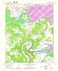
1962 Map of Hoffman
USGS Topo · Published 1964About this map
The Kansas Oklahoma and Gulf railroad cuts through the northern reach of this quadrangle, serving the settlement of Hoffman, while the landscape to the south is defined by the winding course of the North Canadian River. This early 1960s survey documents a region in transition as the Eufaula Reservoir project began to alter the geography of the Okmulgee and McIntosh county line. Areas marked for controlled inundation surround the Deep Fork and its tributaries, such as Cat Creek and Sevenmile Slough. Away from the rising waters, the survey captures the rural infrastructure of the Tiger Mountain and McDaniels areas, including numerous gas wells and small community hubs like Tiger Mountain School and the Thompson Cemetery. The map also preserves the locations of several burial grounds, including the Morrison Cemetery and Hoffman Cemetery, essential for genealogical research in this part of Oklahoma.
Find a feature on this map
27 named features on this map. Tap any name to fly to it.
Don’t see what you’re looking for? This feature index may not catch every label — zoom into the map to look around manually.
Map Details
Editions of this 1962 Hoffman Map
2 editions found
Other maps of this area

1896 · Okmulgee
USGS Topo · 1:125,000

1900 · Canadian
USGS Topo · 1:125,000

1900 · Okmulgee
USGS Topo · 1:125,000

1946 · Fort Smith
USGS Topo · 1:250,000

1962 · Henryetta
USGS Topo · 1:24,000

1962 · Raiford
USGS Topo · 1:24,000

1962 · Henryetta SW
USGS Topo · 1:24,000

1962 · Pierce
USGS Topo · 1:24,000

1963 · Stidham
USGS Topo · 1:24,000

1965 · Fort Smith
USGS Topo · 1:250,000