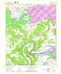
1962 Map of Hoffman
USGS Topo · Published 1979About this map
Hoffman sits at the northern edge of this survey, where the Old Railroad Grade and Cat Creek transition into the expansive waters of Eufaula Lake. This 1960s landscape, updated in the late 1970s, captures the intersection of Okmulgee and McIntosh counties during the mid-century development of the region's water resources. The terrain is marked by significant topographical rises such as McDaniels and Ryals, with the North Canadian River winding through the southern portion of the quadrangle.
Find a feature on this map
28 named features on this map. Tap any name to fly to it.
Don’t see what you’re looking for? This feature index may not catch every label — zoom into the map to look around manually.
Map Details
Editions of this 1962 Hoffman Map
2 editions found
Other maps of this area

1896 · Okmulgee
USGS Topo · 1:125,000

1900 · Canadian
USGS Topo · 1:125,000

1900 · Okmulgee
USGS Topo · 1:125,000

1946 · Fort Smith
USGS Topo · 1:250,000

1962 · Henryetta
USGS Topo · 1:24,000

1962 · Raiford
USGS Topo · 1:24,000

1962 · Henryetta SW
USGS Topo · 1:24,000

1962 · Pierce
USGS Topo · 1:24,000

1962 · Hoffman
USGS Topo · 1:24,000

1963 · Stidham
USGS Topo · 1:24,000