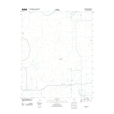
2012 Map of Raiford
USGS Topo · Published 2012About this map
The N Canadian River flows along the northern edge of this McIntosh County landscape, anchoring a network of drainages that includes Piney Cr, Limbo Cr, and Gar Cr. The small community of Raiford is situated in the southern portion of the quadrangle, connected by a grid of rural routes like Red Hill Rd and E1200 Rd. This 2012 survey illustrates the modern rural character of the area, where aviation interests are represented by the Canadian River Ranch Airport. The terrain transitions from the lowlands of Flat Rock Cr and Wallace Cr to the distinctive indentation of Cedar Hollow. This map provides a clear record of the local road network and water systems, which are essential for understanding contemporary land use and property boundaries in this part of eastern Oklahoma.
Find a feature on this map
23 named features on this map. Tap any name to fly to it.
Don’t see what you’re looking for? This feature index may not catch every label — zoom into the map to look around manually.
Map Details
Editions of this 2012 Raiford Map
This is the sole edition of this map. No revisions or reprints were ever made.
Other maps of this area

1900 · Canadian
USGS Topo · 1:125,000

1946 · Fort Smith
USGS Topo · 1:250,000

1962 · Henryetta
USGS Topo · 1:24,000

1962 · Raiford
USGS Topo · 1:24,000

1962 · Henryetta SW
USGS Topo · 1:24,000

1962 · Pierce
USGS Topo · 1:24,000

1962 · Hoffman
USGS Topo · 1:24,000

1963 · Stidham
USGS Topo · 1:24,000

1965 · Fort Smith
USGS Topo · 1:250,000

1967 · Fort Smith
USGS Topo · 1:250,000