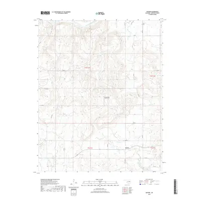
2018 Map of Raiford
USGS Topo · Published 2018About this map
The North Canadian River meanders across the northern reaches of this McIntosh County landscape, defining a terrain carved by numerous tributaries. Small settlements such as Raiford and Lenna anchor the rural road network, providing points of reference for genealogists and local historians. To the north, the Lenna Cem serves as a significant site for family history research. The area is characterized by a series of distinct drainages including Limbo Cr, Gar Cr, and Flat Rock Cr, which cut through the hills. A notable modern landmark is the Canadian River Ranch Airport, situated on a plateau between the river and the southern creeks. The map also captures the varied topography of Cedar Hollow and Spring Hollow, illustrating the natural drainage patterns that have influenced land use and travel routes in this part of Oklahoma.
Find a feature on this map
32 named features on this map. Tap any name to fly to it.
Don’t see what you’re looking for? This feature index may not catch every label — zoom into the map to look around manually.
Map Details
Editions of this 2018 Raiford Map
This is the sole edition of this map. No revisions or reprints were ever made.
Other maps of this area

1900 · Canadian
USGS Topo · 1:125,000

1946 · Fort Smith
USGS Topo · 1:250,000

1962 · Henryetta
USGS Topo · 1:24,000

1962 · Raiford
USGS Topo · 1:24,000

1962 · Henryetta SW
USGS Topo · 1:24,000

1962 · Pierce
USGS Topo · 1:24,000

1962 · Hoffman
USGS Topo · 1:24,000

1963 · Stidham
USGS Topo · 1:24,000

1965 · Fort Smith
USGS Topo · 1:250,000

1967 · Fort Smith
USGS Topo · 1:250,000