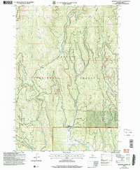
2004 Map of Railroad Saddle
USGS Topo · Published 2007About this map
Payette National Forest dominates this topographic study of the Idaho high country, where the headwaters of the Price Valley Weiser River begin their descent. The landscape is defined by a complex network of drainages including Boulder Creek and Mud Creek, which carve through the terrain near Brush Mountain. Evidence of early water management is visible in the Vantis Ditch, which cuts across the central slopes, while a Gaging Sta on the southern riverbank indicates the long-standing importance of monitoring these vital mountain watersheds.
Find a feature on this map
23 named features on this map. Tap any name to fly to it.
Don’t see what you’re looking for? This feature index may not catch every label — zoom into the map to look around manually.
Map Details
Editions of this 2004 Railroad Saddle Map
This is the sole edition of this map. No revisions or reprints were ever made.
Other maps of this area

1911 · Meadows
USGS Topo · 1:125,000

1920 · Seven Devils Mining District
USGS Topo · 1:48,000

1938 · Riggins
USGS Topo · 1:96,000

1945 · Riggins
USGS Topo · 1:125,000

1954 · New Meadows
USGS Topo · 1:62,500

1955 · Baker
USGS Topo · 1:250,000

1955 · Grangeville
USGS Topo · 1:250,000

1957 · Cuprum
USGS Topo · 1:62,500

1957 · Hornet
USGS Topo · 1:62,500

1959 · Baker
USGS Topo · 1:250,000