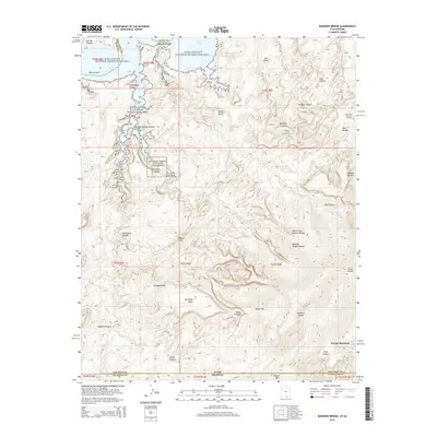
2014 Map of Rainbow Bridge
USGS Topo · Published 2014About this map
Rainbow Bridge National Monument centers this 2014 survey, highlighting the iconic Rainbow Bridge where it spans its namesake canyon. The landscape is defined by the high-elevation slopes of Navajo Mtn in the southeast, transitioning into the deeply incised drainages that feed toward the northern reaches of Lake Powell. This corner of the Glen Canyon National Recreation Area demonstrates a complex network of geological features, including the narrow Redbud Pass and prominent landmarks like Dougi Butte and White Crag Natural Bridge. The map detail follows the varied terrain from the high Rainbow Plateau down through Cliff Canyon and Forbidding Canyon, illustrating the isolation and natural connectivity of the desert floor and the mountain. Local features such as Rainbow Lodge Spring and Johnsons Hole offer specific points of interest for those studying the area's hydrology and navigation routes.
Find a feature on this map
46 named features on this map. Tap any name to fly to it.
Don’t see what you’re looking for? This feature index may not catch every label — zoom into the map to look around manually.
Map Details
Editions of this 2014 Rainbow Bridge Map
This is the sole edition of this map. No revisions or reprints were ever made.
Other maps of this area

1883 · Marsh Pass
USGS Topo · 1:250,000

1886 · Escalante
USGS Topo · 1:250,000

1886 · Henry Mountains
USGS Topo · 1:250,000

1886 · Echo Cliffs
USGS Topo · 1:250,000

1891 · Echo Cliffs
USGS Topo · 1:250,000

1892 · Marsh Pass
USGS Topo · 1:250,000

1892 · Henry Mountains
USGS Topo · 1:250,000

1953 · Cummings Mesa
USGS Topo · 1:62,500

1953 · Navajo Mountain
USGS Topo · 1:62,500

1954 · Navajo Creek
USGS Topo · 1:62,500