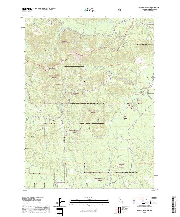
2022 Map of Rainbow Mountain
USGS Topo · Published 2022About this map
Klamath National Forest and Shasta National Forest meet in this high-elevation landscape dominated by volcanic landforms and alpine drainage systems. The survey is centered on the prominent Rainbow Mtn, which serves as a topographic anchor for the surrounding Hemlock Ridge and Dry Creek Peak. This terrain is characterized by a series of distinct volcanic features, including Watakma Butte, Trout Creek Butte, and Fons Butte. The map provides a detailed view of the water resources that define the region, from the clustered Antelope Cr Lakes and Frog Lake to the vital Cramer Spring and Dry Creek Spring. A network of established forest routes, such as the Rainbow Trl and Stevens Pass Rd, facilitates movement through the mountain passes, while the small clearing of Elk Flat represents one of the few named level landmarks in this vertical environment.
Find a feature on this map
34 named features on this map. Tap any name to fly to it.
Don’t see what you’re looking for? This feature index may not catch every label — zoom into the map to look around manually.
Map Details
Editions of this 2022 Rainbow Mountain Map
This is the sole edition of this map. No revisions or reprints were ever made.
Other maps of this area

1886 · Modoc Lava Bed
USGS Topo · 1:250,000

1886 · Shasta
USGS Topo · 1:250,000

1892 · Modoc Lava-Bed
USGS Topo · 1:250,000

1894 · Shasta
USGS Topo · 1:250,000

1932 · Bartle
USGS Topo · 1:96,000

1934 · Macdoel
USGS Topo · 1:96,000

1935 · Dunsmuir
USGS Topo · 1:125,000

1939 · Bartle
USGS Topo · 1:125,000

1941 · Macdoel
USGS Topo · 1:125,000

1948 · Weed
USGS Topo · 1:250,000