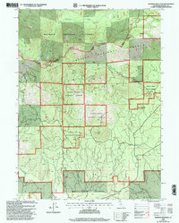
1998 Map of Rainbow Mountain
USGS Topo · Published 2003About this map
Rainbow Mountain stands as a central peak in this high-altitude landscape where the Klamath National Forest and Shasta-Trinity National Forests converge. Surveyed in the late 1990s, the map reveals a wilderness defined by its volcanic topography and water resources, featuring prominent heights like Watakma Butte and Dry Creek Peak. The drainages of Antelope Creek and Trout Creek create a complex network of seasonal flows and permanent springs, such as Cramer Spring and Dry Creek Spring, which have historically supported local wildlife and transit. Human presence is concentrated around the Trout Creek Campground and utility-focused landmarks like the Cinder Pit and Deter Well, illustrating how the land has been managed for both recreation and forest resources within Siskiyou County.
Find a feature on this map
28 named features on this map. Tap any name to fly to it.
Don’t see what you’re looking for? This feature index may not catch every label — zoom into the map to look around manually.
Map Details
Editions of this 1998 Rainbow Mountain Map
This is the sole edition of this map. No revisions or reprints were ever made.
Other maps of this area

1886 · Modoc Lava Bed
USGS Topo · 1:250,000

1886 · Shasta
USGS Topo · 1:250,000

1892 · Modoc Lava-Bed
USGS Topo · 1:250,000

1894 · Shasta
USGS Topo · 1:250,000

1932 · Bartle
USGS Topo · 1:96,000

1934 · Macdoel
USGS Topo · 1:96,000

1935 · Dunsmuir
USGS Topo · 1:125,000

1939 · Bartle
USGS Topo · 1:125,000

1941 · Macdoel
USGS Topo · 1:125,000

1948 · Weed
USGS Topo · 1:250,000