2023 Map of Rainelle
USGS Topo · Published 2023About this map
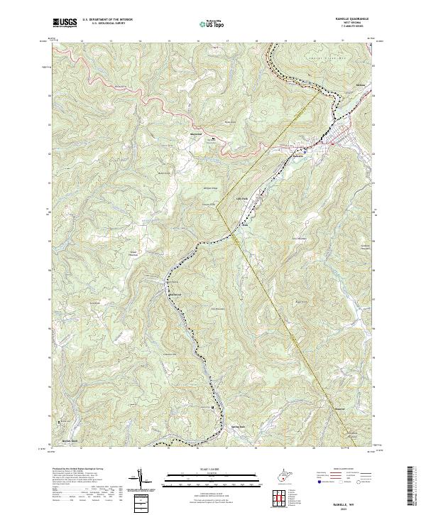
The town of Rainelle serves as a focal point for this Greenbrier and Fayette County borderland, situated where Sewell Creek and Little Sewell Creek converge. The landscape is defined by the high ridges of Sewell Mountain and Sims Mountain, with the Midland Trl and Kanawha Ave providing the primary east-west corridors. This 2023 edition documents contemporary infrastructure, notably the Meadow River Rail Trail currently under development along the Meadow River, repurposing former industrial rail corridors for modern recreational use.
Find a feature on this map
102 named features on this map. Tap any name to fly to it.
Don’t see what you’re looking for? This feature index may not catch every label — zoom into the map to look around manually.
Map Details
Editions of this 2023 Rainelle Map
This is the sole edition of this map. No revisions or reprints were ever made.