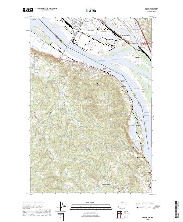
2024 Map of Rainier
USGS Topo · Published 2024About this map
The Columbia River dominates this modern landscape, serving as the border between Washington and Oregon and shaping the economic life of Rainier and its surrounding riverfront communities. The map captures the complex industrial and maritime infrastructure along the water, from the Log Pond and Ditch Number Three in the north to the Cottonwood Island Upper Range downstream. Inland, the terrain rises into the wooded hills and valleys of Beaver Valley, where small rural settlements like Beaver Springs and Beaver Homes persist alongside numerous local landmarks like Beaver Creek and Girt Creek.
Find a feature on this map
143 named features on this map. Tap any name to fly to it.
Don’t see what you’re looking for? This feature index may not catch every label — zoom into the map to look around manually.
Map Details
Editions of this 2024 Rainier Map
This is the sole edition of this map. No revisions or reprints were ever made.
Other maps of this area

1919 · Mayger
USGS Topo · 1:62,500

1921 · Kalama
USGS Topo · 1:62,500

1922 · St. Helens
USGS Topo · 1:62,500

1940 · Vernonia
USGS Topo · 1:62,500

1941 · St Helens
USGS Topo · 1:62,500

1941 · Clatskanie
USGS Topo · 1:62,500

1943 · Vernonia
USGS Topo · 1:62,500

1943 · St Helens
USGS Topo · 1:62,500

1948 · Vancouver
USGS Topo · 1:250,000

1950 · Vancouver
USGS Topo · 1:250,000