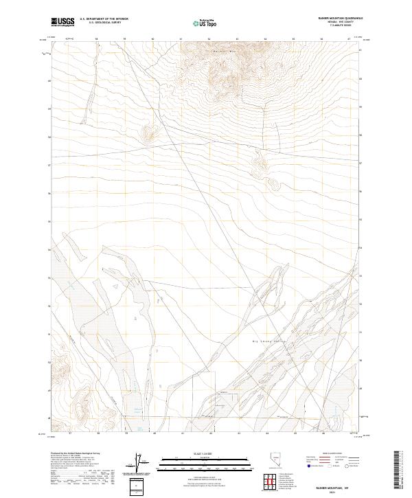
2021 Map of Rainier Mountain
USGS Topo · Published 2021About this map
Rainier Mtn dominates the northern horizon of this landscape in Nye County, where the high terrain gives way to the broad expanse of the Big Smoky Valley. This area is defined by its drainage patterns, with intermittent flows like Ione Wash and Idlewild Creek carving paths through the alluvial fans. In the southeast, Peavine Creek marks a distinct drainage as it enters the valley floor.
Find a feature on this map
12 named features on this map. Tap any name to fly to it.
Don’t see what you’re looking for? This feature index may not catch every label — zoom into the map to look around manually.
Map Details
Editions of this 2021 Rainier Mountain Map
This is the sole edition of this map. No revisions or reprints were ever made.
Other maps of this area

1907 · Tonopah
USGS Topo · 1:250,000

1908 · Tonopah
USGS Topo · 1:250,000

1956 · Tonopah
USGS Topo · 1:250,000

1959 · Tonopah
USGS Topo · 1:250,000

1962 · Tonopah
USGS Topo · 1:250,000

1964 · San Antonio Ranch
USGS Topo · 1:62,500
1980 · Cloverdale Ranch
USGS Topo · 1:24,000
1980 · Outlaw Springs SE
USGS Topo · 1:24,000
1980 · Outlaw Springs NE
USGS Topo · 1:24,000

1980 · Secret Basin
USGS Topo · 1:24,000