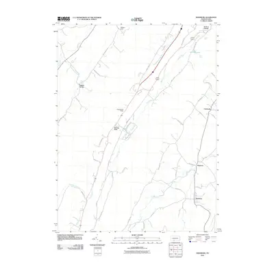
2010 Map of Rainsburg
USGS Topo · Published 2010About this map
Cumberland Valley anchors this corner of Bedford County, defined by its numerous mineral springs and rural hamlets in the early 21st century. The landscape is dotted with named water sources such as Magnesium Spring, Crystal Spring, and the prominent White Sulphur Springs area, reflecting the region's long-standing identity as a destination for natural spring water. Small crossroads and settlements like Rainsburg, Beegleton, and the curiously named Burning Bush are connected by a network of local routes, including Glade Pike and Cumberland RD. This topography highlights the narrow valleys formed by Shobers Run, Evitts Creek, and Cove Creek, which dictate the placement of local homesteads and roads. The presence of Bedford Springs at the northern edge suggests the continued importance of these hydrogeological features to the local economy and geography.
Find a feature on this map
49 named features on this map. Tap any name to fly to it.
Don’t see what you’re looking for? This feature index may not catch every label — zoom into the map to look around manually.
Map Details
Editions of this 2010 Rainsburg Map
This is the sole edition of this map. No revisions or reprints were ever made.
Other maps of this area

1900 · Everett
USGS Topo · 1:62,500

1902 · Everett
USGS Topo · 1:62,500

1908 · Bedford
USGS Topo · 1:62,500

1910 · Bedford
USGS Topo · 1:62,500

1927 · Clearville
USGS Topo · 1:48,000

1927 · Hyndman
USGS Topo · 1:62,500

1931 · Clearville
USGS Topo · 1:62,500

1931 · Hyndman
USGS Topo · 1:62,500

1944 · Hyndman
USGS Topo · 1:62,500

1944 · Clearville
USGS Topo · 1:62,500
Featured Places
- Rainsburg, PA
- Colerain Township, PA
- Bedford Township, PA
- Harrison Township, PA
- Sulphur Springs, Harrison Township