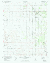
1963 Map of Raisin
USGS Topo · Published 1964About this map
Raisin City anchors this agricultural landscape in the San Joaquin Valley, where a rigid grid of avenues and irrigation infrastructure defines the terrain. The presence of Liberty Ditch and the Millrace in the southern sections underscores the heavy reliance on water management to sustain the local economy. An intriguing social landmark, the Drag Strip located near Grantland Ave, suggests a local culture of recreation amidst the expansive field crops.
Find a feature on this map
51 named features on this map. Tap any name to fly to it.
Don’t see what you’re looking for? This feature index may not catch every label — zoom into the map to look around manually.
Map Details
Editions of this 1963 Raisin Map
This is the sole edition of this map. No revisions or reprints were ever made.
Other maps of this area

1912 · Coalinga
USGS Topo · 1:125,000

1923 · Kearney Park
USGS Topo · 1:31,680

1923 · Fresno
USGS Topo · 1:31,680

1924 · Riverdale
USGS Topo · 1:31,680

1925 · Helm
USGS Topo · 1:31,680

1925 · Raisin
USGS Topo · 1:31,680

1925 · Caruthers
USGS Topo · 1:31,680

1927 · Burrel
USGS Topo · 1:31,680

1927 · Riverdale
USGS Topo · 1:31,680

1931 · Wheatville
USGS Topo · 1:31,680