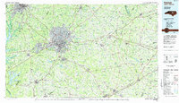
1984 Map of Raleigh
USGS Topo · Published 1985About this map
The capital city of Raleigh and its surrounding Research Triangle neighbors are captured here in the mid-1980s, a period of significant suburban expansion and infrastructure development. The map details the emergence of major water features like B. Everett Jordan Lake, Falls Lake, and Harris Reservoir, which reshaped the local landscape and recreational opportunities. Extensive regional facilities are prominent, including the grounds of Dorothea Dix State Hospital and the State Prison.
Find a feature on this map
76 named features on this map. Tap any name to fly to it.
Don’t see what you’re looking for? This feature index may not catch every label — zoom into the map to look around manually.
Map Details
Editions of this 1984 Raleigh Map
This is the sole edition of this map. No revisions or reprints were ever made.
Other maps of this area

1902 · Kenly
USGS Topo · 1:62,500

1902 · Rocky Mount
USGS Topo · 1:62,500

1902 · Spring Hope
USGS Topo · 1:62,500

1903 · Kenly
USGS Topo · 1:62,500

1904 · Rocky Mount
USGS Topo · 1:62,500

1904 · Springhope
USGS Topo · 1:62,500

1904 · Wilson
USGS Topo · 1:62,500

1906 · Four Oaks
USGS Topo · 1:48,000

1908 · Four Oaks
USGS Topo · 1:62,500

1943 · Durham South
USGS Topo · 1:62,500