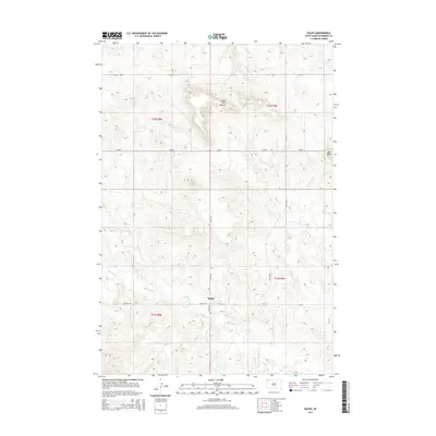
2015 Map of Ralph
USGS Topo · Published 2015About this map
Ralph serves as the central focal point of this Harding County survey, situated at the intersection of Ralph Rd, Lincoln Rd, and Wagner Rd. The landscape is defined by its drainage systems and distinct elevations, most notably the Lodge Pole Buttes rising north of the main settlement. Waterways like Big Nasty Cr and Teeter Cr carve through the prairie, illustrating the drainage patterns that have historically dictated road placement and ranching boundaries in this corner of South Dakota. To the northeast, the terrain levels toward Mud Butte, while a network of rural routes including Vessey Loop and CR-858 connects the isolated homesteads and pastures. The map provides a clear picture of the modern township structure, showing the organized grid of section lines that overlay this sparsely populated ranching country.
Find a feature on this map
18 named features on this map. Tap any name to fly to it.
Don’t see what you’re looking for? This feature index may not catch every label — zoom into the map to look around manually.
Map Details
Editions of this 2015 Ralph Map
This is the sole edition of this map. No revisions or reprints were ever made.
Other maps of this area

1935 · Reva
USGS Topo · 1:125,000

1954 · Lemmon
USGS Topo · 1:250,000

1957 · Lemmon
USGS Topo · 1:250,000

1968 · Ralph SW
USGS Topo · 1:24,000

1968 · Haley
USGS Topo · 1:24,000

1968 · Bowman-Haley Dam
USGS Topo · 1:24,000

1968 · Ralph
USGS Topo · 1:24,000

1969 · Reva NW
USGS Topo · 1:24,000

1969 · Reva NE
USGS Topo · 1:24,000

1974 · Cow Butte
USGS Topo · 1:24,000