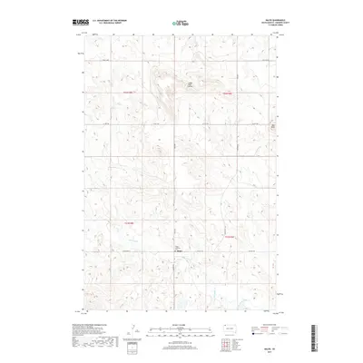
2017 Map of Ralph
USGS Topo · Published 2017About this map
The small settlement of Ralph stands as a focal point in this portion of Harding County, situated at the junction of Ralph Rd and Lincoln Rd. This High Plains landscape is defined by its drainage systems and prominent landmarks, notably the Lodge Pole Buttes and the aptly named Mud Butte. Waterways such as Teeter Cr and the descriptively titled Big Nasty Creek thread through the township sections, illustrating the hydrologic character of this northern South Dakota region. For those researching local heritage or genealogy, the Ralph Lutheran Cem provides a tangible link to the community's history. The map also delineates a network of rural routes, including Co Hwy 858 and Vessey Loop, which connect the isolated homesteads and ranch lands that define the area's modern land use.
Find a feature on this map
21 named features on this map. Tap any name to fly to it.
Don’t see what you’re looking for? This feature index may not catch every label — zoom into the map to look around manually.
Map Details
Editions of this 2017 Ralph Map
This is the sole edition of this map. No revisions or reprints were ever made.
Other maps of this area

1935 · Reva
USGS Topo · 1:125,000

1954 · Lemmon
USGS Topo · 1:250,000

1957 · Lemmon
USGS Topo · 1:250,000

1968 · Ralph SW
USGS Topo · 1:24,000

1968 · Haley
USGS Topo · 1:24,000

1968 · Bowman-Haley Dam
USGS Topo · 1:24,000

1968 · Ralph
USGS Topo · 1:24,000

1969 · Reva NW
USGS Topo · 1:24,000

1969 · Reva NE
USGS Topo · 1:24,000

1974 · Cow Butte
USGS Topo · 1:24,000