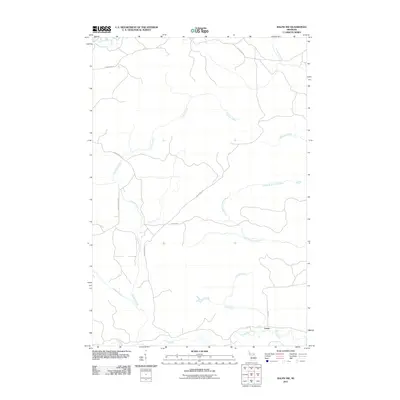
2011 Map of Ralph NW
USGS Topo · Published 2011About this map
The Ford River and its various tributaries define this section of Marquette County, where a complex network of waterways drains the forested landscape. In the southern reach, the small settlement of Turner sits near the intersection of Hintz Rd and the river, marking a point of human habitation in a largely rural area. The hydrology is particularly dense here, featuring several named creeks including Tuomile Creek, Weber Creek, and McGregor Creek, which feed into the North Branch Ford River. A network of utility roads and local tracks like Big Wheels Rd and Floodwood Rd provides access through the terrain, suggesting a history of logging or land management. This 2011 survey captures the area's transition into the 21st century, showing how modern roads like Forest Rd continue to trace historical routes through the Michigan woods.
Find a feature on this map
14 named features on this map. Tap any name to fly to it.
Don’t see what you’re looking for? This feature index may not catch every label — zoom into the map to look around manually.
Map Details
Editions of this 2011 Ralph NW Map
This is the sole edition of this map. No revisions or reprints were ever made.
Other maps of this area

1899 · Sagola
USGS Topo · 1:62,500

1899 · Witbeck
USGS Topo · 1:62,500

1955 · Witch Lake
USGS Topo · 1:24,000

1955 · Ralph NW
USGS Topo · 1:24,000

1955 · Ralph NE
USGS Topo · 1:24,000

1955 · Republic
USGS Topo · 1:62,500

1955 · Witch Lake
USGS Topo · 1:62,500

1955 · Republic SW
USGS Topo · 1:24,000

1955 · Ralph
USGS Topo · 1:62,500
1955 · Channing
USGS Topo · 1:24,000