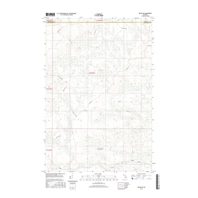
2017 Map of Ralph NW
USGS Topo · Published 2017About this map
The Ford River and its northern branch dominate this Upper Peninsula landscape, where water drainage patterns dictate the layout of the local timber and hunting roads. Near the southeastern corner, the small settlement of Turner serves as the primary landmark, situated at the junction of Turner RD and Hintz RD. The terrain is defined by a dense network of tributaries including Twomile Cr, Webber Creek, and McGregor Cr, which cut through the forested interior. Historical land use is evidenced by descriptive road names such as Big Wheels Rd and Big Stump Trl, hinting at the region's logging heritage. The boundary between Marquette and Dickinson Counties runs across the northern edge of the map, marking a transition in local jurisdiction across this largely uninhabited wilderness.
Find a feature on this map
27 named features on this map. Tap any name to fly to it.
Don’t see what you’re looking for? This feature index may not catch every label — zoom into the map to look around manually.
Map Details
Editions of this 2017 Ralph NW Map
This is the sole edition of this map. No revisions or reprints were ever made.
Other maps of this area

1899 · Sagola
USGS Topo · 1:62,500

1899 · Witbeck
USGS Topo · 1:62,500

1955 · Witch Lake
USGS Topo · 1:24,000

1955 · Ralph NW
USGS Topo · 1:24,000

1955 · Ralph NE
USGS Topo · 1:24,000

1955 · Republic
USGS Topo · 1:62,500

1955 · Witch Lake
USGS Topo · 1:62,500

1955 · Republic SW
USGS Topo · 1:24,000

1955 · Ralph
USGS Topo · 1:62,500
1955 · Channing
USGS Topo · 1:24,000