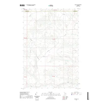
2019 Map of Ralph NW
USGS Topo · Published 2019About this map
The Ford River and its numerous tributaries dominate this northern Michigan landscape, where the boundary between Marquette Co and Dickinson Co defines the southern extent of the survey. The settlement of Turner serves as the primary point of interest in the southeastern corner, connected to the surrounding timberlands by a network of logging and forest roads. The terrain is characterized by a complex drainage system, including the N Br Ford River, Twomile Cr, and Schwartz Cr.
Find a feature on this map
21 named features on this map. Tap any name to fly to it.
Don’t see what you’re looking for? This feature index may not catch every label — zoom into the map to look around manually.
Map Details
Editions of this 2019 Ralph NW Map
This is the sole edition of this map. No revisions or reprints were ever made.
Other maps of this area

1899 · Sagola
USGS Topo · 1:62,500

1899 · Witbeck
USGS Topo · 1:62,500

1955 · Witch Lake
USGS Topo · 1:24,000

1955 · Ralph NW
USGS Topo · 1:24,000

1955 · Ralph NE
USGS Topo · 1:24,000

1955 · Republic
USGS Topo · 1:62,500

1955 · Witch Lake
USGS Topo · 1:62,500

1955 · Republic SW
USGS Topo · 1:24,000

1955 · Ralph
USGS Topo · 1:62,500
1955 · Channing
USGS Topo · 1:24,000