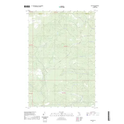
2023 Map of Ralph NW
USGS Topo · Published 2023About this map
The North Branch Ford River and the main Ford River define this Upper Peninsula landscape along the border of Marquette and Dickinson counties. This 2023 survey shows a region deeply shaped by its watercourses and a network of logging and recreational tracks. North of the river, Twomile Creek and Schwartz Creek cut through the forest, accessed by routes with names evocative of the region's timber history, such as Big Wheels Rd and Big Stump Trl. The map details the modern configuration of these backroads, including Two Mile Creek Rd and Floodwood Rd, alongside numerous forest trails like Ups Trl. Smaller tributaries like Turner Creek and Webber Creek feed into the larger river system, illustrating the intricate drainage patterns of this wooded territory in northern Michigan.
Find a feature on this map
28 named features on this map. Tap any name to fly to it.
Don’t see what you’re looking for? This feature index may not catch every label — zoom into the map to look around manually.
Map Details
Editions of this 2023 Ralph NW Map
This is the sole edition of this map. No revisions or reprints were ever made.
Other maps of this area

1899 · Sagola
USGS Topo · 1:62,500

1899 · Witbeck
USGS Topo · 1:62,500

1955 · Witch Lake
USGS Topo · 1:24,000

1955 · Ralph NW
USGS Topo · 1:24,000

1955 · Ralph NE
USGS Topo · 1:24,000

1955 · Republic
USGS Topo · 1:62,500

1955 · Witch Lake
USGS Topo · 1:62,500

1955 · Republic SW
USGS Topo · 1:24,000

1955 · Ralph
USGS Topo · 1:62,500
1955 · Channing
USGS Topo · 1:24,000