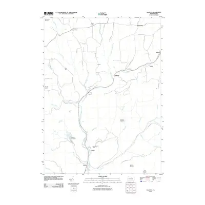
2010 Map of Ralston
USGS Topo · Published 2010About this map
Ralston and Roaring Branch serve as the primary hubs in this mountainous region of Tioga County, where the landscape is defined by the steep valleys of Lycoming Creek and its many tributaries. The area features a network of small settlements and named hills, including Ogdensburg to the north and the localized peaks of Joe Hill and Pine Hill. A significant portion of the southeastern quadrant is dedicated to the McIntyre Wild Area, a preserve that contains the notable Band Rock Vista overlooking the valley floor. The map documents a rural infrastructure where residential pockets like Dogtown, Newelltown, and Langdon are linked by winding roads such as McIntyre Mountain Rd and Sugar Run Rd. Water management is evident at the Maggio Estate Dam Number Two, while the numerous runs, including Miners Run and Frozen Run, illustrate the complex drainage patterns of the Sullivan Mountain area.
Find a feature on this map
75 named features on this map. Tap any name to fly to it.
Don’t see what you’re looking for? This feature index may not catch every label — zoom into the map to look around manually.
Map Details
Editions of this 2010 Ralston Map
This is the sole edition of this map. No revisions or reprints were ever made.
Other maps of this area

1921 · Trout Run
USGS Topo · 1:62,500

1923 · Trout Run
USGS Topo · 1:62,500

1925 · Blossburg
USGS Topo · 1:62,500

1927 · Blossburg
USGS Topo · 1:62,500

1930 · Warrensville
USGS Topo · 1:62,500

1934 · Warrensville
USGS Topo · 1:62,500

1942 · Canton
USGS Topo · 1:62,500

1944 · Blossburg
USGS Topo · 1:62,500

1944 · Trout Run
USGS Topo · 1:62,500

1944 · Canton
USGS Topo · 1:62,500
Featured Places
- South Union, Union Township
- Newelltown, Union Township
- Leolyn, McNett Township
- Ogdensburg, Union Township
- Union Center, Union Township