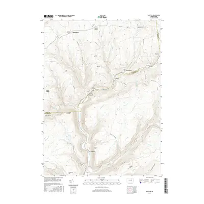
2016 Map of Ralston
USGS Topo · Published 2016About this map
Lycoming Creek flows through the central valley of this northern Pennsylvania landscape, where small hamlets and cemeteries are scattered across the Tioga and Lycoming county line. The settlement of Roaring Branch serves as a focal point near the confluence of Roaring Br and the main creek, while further south, Ralston and Langdon sit deep in the narrow valley floor. The geography is defined by steep ridges and narrow hollows, such as Sixth Bottom Hollow, with prominent heights including Joe Hill and Laurel Hill. Local family history is preserved in several burial grounds, including Stull Cem on the high ground and Roaring Branch Griffin Cem near the water. Higher elevation settlements like Ogdensburg and Union Center are connected by a network of rural routes such as State Rte 2017 and Ogdensburg Rd, tracing the early 21st-century infrastructure of these mountain communities.
Find a feature on this map
67 named features on this map. Tap any name to fly to it.
Don’t see what you’re looking for? This feature index may not catch every label — zoom into the map to look around manually.
Map Details
Editions of this 2016 Ralston Map
This is the sole edition of this map. No revisions or reprints were ever made.
Other maps of this area

1921 · Trout Run
USGS Topo · 1:62,500

1923 · Trout Run
USGS Topo · 1:62,500

1925 · Blossburg
USGS Topo · 1:62,500

1927 · Blossburg
USGS Topo · 1:62,500

1930 · Warrensville
USGS Topo · 1:62,500

1934 · Warrensville
USGS Topo · 1:62,500

1942 · Canton
USGS Topo · 1:62,500

1944 · Blossburg
USGS Topo · 1:62,500

1944 · Trout Run
USGS Topo · 1:62,500

1944 · Canton
USGS Topo · 1:62,500
Featured Places
- South Union, Union Township
- Newelltown, Union Township
- Leolyn, McNett Township
- Ogdensburg, Union Township
- Union Center, Union Township