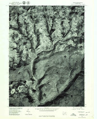
1977 Map of Ralston
USGS Topo · Published 1979About this map
Lycoming Creek carves a deep valley through the northern Pennsylvania landscape, providing the primary corridor for settlement and transit in this 1977 aerial study. The orthophotoquad format reveals the sharp contrast between the densely forested highlands and the cleared agricultural plots surrounding Ogdensburg and Spencertown. Along the valley floor, the village of Ralston sits at a critical bend in the creek, showing the concentrated layout of a riverside community shaped by the narrow geography. Further north, the confluence at Roaring Branch highlights how water-level routes dictated the placement of homesteads and road networks in Lycoming County. This photographic record preserves the exact state of field lines and forest edges before decades of subsequent growth and change.
Find a feature on this map
5 named features on this map. Tap any name to fly to it.
Don’t see what you’re looking for? This feature index may not catch every label — zoom into the map to look around manually.
Map Details
Editions of this 1977 Ralston Map
This is the sole edition of this map. No revisions or reprints were ever made.
Other maps of this area

1921 · Trout Run
USGS Topo · 1:62,500

1923 · Trout Run
USGS Topo · 1:62,500

1925 · Blossburg
USGS Topo · 1:62,500

1927 · Blossburg
USGS Topo · 1:62,500

1930 · Warrensville
USGS Topo · 1:62,500

1934 · Warrensville
USGS Topo · 1:62,500

1942 · Canton
USGS Topo · 1:62,500

1944 · Blossburg
USGS Topo · 1:62,500

1944 · Trout Run
USGS Topo · 1:62,500

1944 · Canton
USGS Topo · 1:62,500
Featured Places
- Leolyn, McNett Township
- Union Township, PA
- Canton Township, PA
- Union Center, Union Township
- Roaring Branch, Union Township