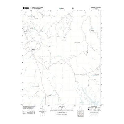
2011 Map of Ramhurst
USGS Topo · Published 2011About this map
Georgia Mine and the Old Cohutta Mine sit in the north, marking a landscape defined by past resource extraction near the community of Ramhurst. The terrain is characterized by numerous watercourses feeding into Carters Lake at the southern edge, including the long reaches of Sugar Creek and Mineral Springs Branch. Small settlements such as Dennis, Coniston, and the evocatively named Bloodtown are connected by a network of local roads and the prominent corridor of Old Highway 411.
Find a feature on this map
65 named features on this map. Tap any name to fly to it.
Don’t see what you’re looking for? This feature index may not catch every label — zoom into the map to look around manually.
Map Details
Editions of this 2011 Ramhurst Map
This is the sole edition of this map. No revisions or reprints were ever made.
Other maps of this area

1886 · Dalton
USGS Topo · 1:125,000

1892 · Dalton
USGS Topo · 1:125,000

1897 · Dalton
USGS Topo · 1:125,000

1911 · Cohutta Mtn
USGS Topo · 1:62,500

1913 · Cohutta Mtn.
USGS Topo · 1:62,500

1914 · Talking Rock
USGS Topo · 1:62,500

1916 · Talking Rock
USGS Topo · 1:62,500

1938 · Chatsworth
USGS Topo · 1:48,000

1943 · Dalton
USGS Topo · 1:62,500
1949 · Calhoun
USGS Topo · 1:62,500