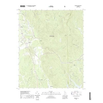
2020 Map of Ramhurst
USGS Topo · Published 2020About this map
Chattahoochee National Forest lands dominate this northern Georgia landscape, where the rugged topography of the Blue Ridge foothills is cut by numerous creek drainages. The settlement patterns follow the winding path of Old Hwy 411, connecting the communities of Ramhurst, Dennis, and Coniston. This modern survey reveals a mix of timbered wilderness and rural residential development, particularly evident in the naming of family-oriented landmarks such as Noah Corbin and Hunter Ridge.
Find a feature on this map
86 named features on this map. Tap any name to fly to it.
Don’t see what you’re looking for? This feature index may not catch every label — zoom into the map to look around manually.
Map Details
Editions of this 2020 Ramhurst Map
This is the sole edition of this map. No revisions or reprints were ever made.
Other maps of this area

1886 · Dalton
USGS Topo · 1:125,000

1892 · Dalton
USGS Topo · 1:125,000

1897 · Dalton
USGS Topo · 1:125,000

1911 · Cohutta Mtn
USGS Topo · 1:62,500

1913 · Cohutta Mtn.
USGS Topo · 1:62,500

1914 · Talking Rock
USGS Topo · 1:62,500

1916 · Talking Rock
USGS Topo · 1:62,500

1938 · Chatsworth
USGS Topo · 1:48,000

1943 · Dalton
USGS Topo · 1:62,500
1949 · Calhoun
USGS Topo · 1:62,500