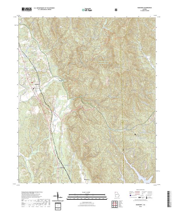
2024 Map of Ramhurst
USGS Topo · Published 2024About this map
Ramhurst and the neighboring settlement of Dennis occupy the transition from the rolling valley floor into the steep, timbered elevations of the Chattahoochee National Forest. This modern record of Murray County shows a landscape defined by small watercourses like Rock Creek and Yellow Creek that drain the ridges. Local family and church history are anchored by sites such as Ramsey Cem and the Ridgeway Baptist Church Cem near the Gilmer County line. The map highlights a rural infrastructure where old routes like the Old Federal Rd S and Dennis Mill Rd intersect with the modern corridor of Hwy 411. Farther south, the curious placename of Bloodtown and the small community of Coniston sit near the winding banks of Rock Spring Branch. For outdoor historians, the path of the Pinhoti Trl is traced as it climbs toward Cold Spring Mtn.
Find a feature on this map
85 named features on this map. Tap any name to fly to it.
Don’t see what you’re looking for? This feature index may not catch every label — zoom into the map to look around manually.
Map Details
Editions of this 2024 Ramhurst Map
This is the sole edition of this map. No revisions or reprints were ever made.
Other maps of this area

1886 · Dalton
USGS Topo · 1:125,000

1892 · Dalton
USGS Topo · 1:125,000

1897 · Dalton
USGS Topo · 1:125,000

1911 · Cohutta Mtn
USGS Topo · 1:62,500

1913 · Cohutta Mtn.
USGS Topo · 1:62,500

1914 · Talking Rock
USGS Topo · 1:62,500

1916 · Talking Rock
USGS Topo · 1:62,500

1938 · Chatsworth
USGS Topo · 1:48,000

1943 · Dalton
USGS Topo · 1:62,500
1949 · Calhoun
USGS Topo · 1:62,500