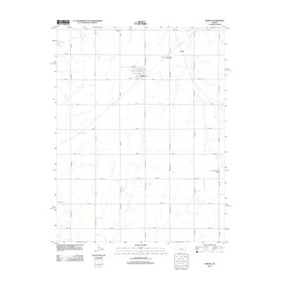
2012 Map of Ramona
USGS Topo · Published 2012About this map
The town of Ramona serves as the central hub of this northern Marion County landscape, displaying a compact grid of streets such as A St and 1st St alongside its local Post Office. This 2012 survey illustrates a predominantly agricultural region defined by a systematic grid of section roads like Old Mill Rd and Pawnee Rd. Genealogical interest is high here, with several well-documented burial grounds scattered throughout the township, including Saint Pauls Evangelical Lutheran Cem, Rosebank Cem, Lewis Cem, and Mohn Cem. The terrain is carved by the drainages of E Turkey Cr and Lyon Cr, while more modern land use is represented by the Flying N Ranch Airport to the southeast. The small settlement of Jacobs appears in the northeast, situated near the headwaters of Cress Cr.
Find a feature on this map
56 named features on this map. Tap any name to fly to it.
Don’t see what you’re looking for? This feature index may not catch every label — zoom into the map to look around manually.
Map Details
Editions of this 2012 Ramona Map
This is the sole edition of this map. No revisions or reprints were ever made.
Other maps of this area

1889 · Newton
USGS Topo · 1:125,000

1889 · Abilene
USGS Topo · 1:125,000

1889 · Parkerville
USGS Topo · 1:125,000

1894 · Newton
USGS Topo · 1:125,000

1894 · Abilene
USGS Topo · 1:125,000

1894 · Parkerville
USGS Topo · 1:125,000

1898 · Cottonwood Falls
USGS Topo · 1:125,000

1955 · Hutchinson
USGS Topo · 1:250,000

1959 · Hutchinson
USGS Topo · 1:250,000

1964 · Elmo
USGS Topo · 1:24,000