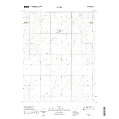
2018 Map of Ramona
USGS Topo · Published 2018About this map
Ramona and the surrounding plains of the Dickinson and Marion County line are captured here in a period of agricultural stability and enduring community landmarks. The settlement of Ramona itself is structured around a central grid of numbered streets like 3rd St and 5th St, while the outlying areas are defined by a network of rural roads such as Pawnee Rd and Quail Creek Rd. The presence of several historic burial grounds, including Rosebank Cem, Lewis Cem, and the Saint Pauls Evangelical Lutheran Cem, provides significant points of interest for genealogists tracing family roots in this corner of Kansas. The landscape is drained by several waterways, notably Lyon Cr and the seasonally varying Lost Spring, which weave through the agricultural sections of Township 17 South.
Find a feature on this map
49 named features on this map. Tap any name to fly to it.
Don’t see what you’re looking for? This feature index may not catch every label — zoom into the map to look around manually.
Map Details
Editions of this 2018 Ramona Map
This is the sole edition of this map. No revisions or reprints were ever made.
Other maps of this area

1889 · Newton
USGS Topo · 1:125,000

1889 · Abilene
USGS Topo · 1:125,000

1889 · Parkerville
USGS Topo · 1:125,000

1894 · Newton
USGS Topo · 1:125,000

1894 · Abilene
USGS Topo · 1:125,000

1894 · Parkerville
USGS Topo · 1:125,000

1898 · Cottonwood Falls
USGS Topo · 1:125,000

1955 · Hutchinson
USGS Topo · 1:250,000

1959 · Hutchinson
USGS Topo · 1:250,000

1964 · Elmo
USGS Topo · 1:24,000