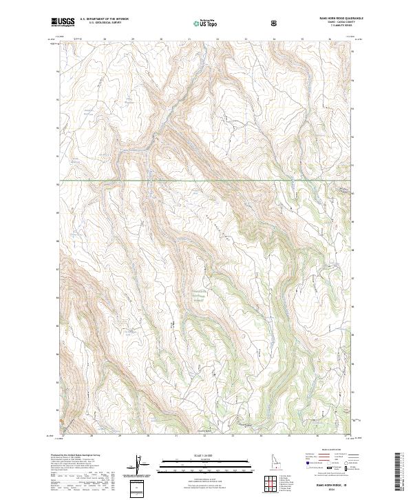
2024 Map of Rams Horn Ridge
USGS Topo · Published 2024About this map
Sawtooth National Forest dominates this section of southern Idaho, where the high terrain of Rams Horn Ridge separates various drainages of the Dry Creek system. Water management is a primary feature of this landscape, evidenced by the presence of the Fuller Reservoir, Deadeye Reservoir, and Keith Reservoir in the northern portion of the quadrangle. These man-made structures contrast with the natural network of canyons and hollows, such as Buckhorn Canyon and Horse Hollow. Numerous seasonal and perennial sources, including Jeffs Spring, Porcupine Spring, and Antelope Spring, are identified throughout the forest. Transportation is limited to a few specific corridors, most notably Dry Creek Rd and the Harrington Fork Trl, which provide access to more remote locations like Coal Pit Butte and Wahlstrom Hollow.
Find a feature on this map
41 named features on this map. Tap any name to fly to it.
Don’t see what you’re looking for? This feature index may not catch every label — zoom into the map to look around manually.
Map Details
Editions of this 2024 Rams Horn Ridge Map
This is the sole edition of this map. No revisions or reprints were ever made.
Other maps of this area

1955 · Twin Falls
USGS Topo · 1:250,000

1958 · Twin Falls
USGS Topo · 1:250,000

1965 · Rams Horn Ridge
USGS Topo · 1:24,000

1965 · Milner Butte
USGS Topo · 1:24,000

1965 · Stricker Butte
USGS Topo · 1:24,000

1965 · Grand View Peak
USGS Topo · 1:24,000

1965 · Murtaugh
USGS Topo · 1:24,000

1965 · Buckhorn Canyon
USGS Topo · 1:24,000
1978 · Pike Mountain
USGS Topo · 1:24,000
1978 · Severe Spring
USGS Topo · 1:24,000