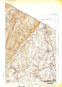
1940 Map of Ramsey
USGS Topo · Published 1940About this map
Ramapo River cuts a prominent path through this 1940 edition, defining the valley between the steep ridges of Campgaw Mountain and the western highlands. The settlement pattern reveals the developing suburban character of Bergen County, centered on the Erie railroad corridor where towns like Ramsey, Allendale, and Waldwick are clearly established along the Franklin Turnpike. To the north, the landscape transitions into more private and institutional uses, evidenced by the Immaculate Conception Seminary and the Don Bosco Institute, alongside recreation-focused developments such as the Houvenkopf Country Club and Bear Lake Club. The map provides an intricate look at local water management, showing numerous reservoirs and ponds including MacMillan Reservoir and Havemeyer Reservoir, which were critical to the region's expanding infrastructure before the post-war building boom fully transformed these wooded uplands.
Find a feature on this map
70 named features on this map. Tap any name to fly to it.
Don’t see what you’re looking for? This feature index may not catch every label — zoom into the map to look around manually.
Map Details
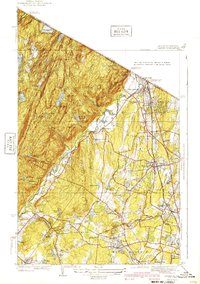
Editions of this 1940 Ramsey Map
2 editions found
Other maps of this area

1888 · Morristown
USGS Topo · 1:62,500

1888 · Paterson
USGS Topo · 1:62,500

1891 · Greenwood Lake
USGS Topo · 1:62,500

1891 · Ramapo
USGS Topo · 1:62,500

1892 · Paterson
USGS Topo · 1:62,500

1893 · Greenwood Lake
USGS Topo · 1:62,500

1893 · Ramapo
USGS Topo · 1:62,500

1894 · Morristown
USGS Topo · 1:62,500

1898 · Morristown
USGS Topo · 1:62,500

1898 · Paterson
USGS Topo · 1:62,500