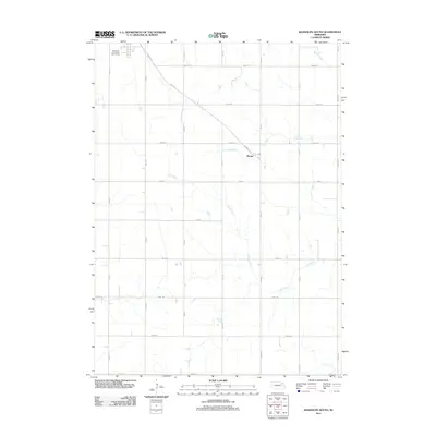
2011 Map of Randolph South
USGS Topo · Published 2011About this map
Sholes sits as the central point of interest in this agricultural landscape of Cedar County, where the regular grid of section roads meets the natural drainage of the Nebraska plains. The terrain is defined by a series of north-flowing waterways, including Dog Creek and the meandering Deer Creek, which create subtle variations in the otherwise structured township layout. To the northwest, the Randolph Community Golf Course marks the edge of the nearby population center, while a network of rural routes like Sholes Rd and 864th Rd facilitate movement between family farms. This survey captures the region's enduring character as a productive farming district, organized around small rail-era settlements and the essential water sources of the Baker Creek watershed.
Find a feature on this map
23 named features on this map. Tap any name to fly to it.
Don’t see what you’re looking for? This feature index may not catch every label — zoom into the map to look around manually.
Map Details
Editions of this 2011 Randolph South Map
This is the sole edition of this map. No revisions or reprints were ever made.
Other maps of this area

1955 · Sioux City
USGS Topo · 1:250,000

1958 · Sioux City
USGS Topo · 1:250,000

1959 · Sioux City
USGS Topo · 1:250,000

1963 · Winside
USGS Topo · 1:24,000

1963 · Wee Town
USGS Topo · 1:24,000

1963 · Norfolk NE
USGS Topo · 1:24,000

1971 · Belden
USGS Topo · 1:24,000

1971 · Randolph South
USGS Topo · 1:24,000

1971 · Randolph North
USGS Topo · 1:24,000
1971 · Randolph SW
USGS Topo · 1:24,000