
1963 Map of Norfolk NE
USGS Topo · Published 1964About this map
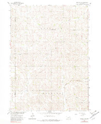
Agricultural life in the early 1960s defines this section of the Pierce and Wayne County border, where a network of rural school districts and community churches served the farming population. The map captures the physical layout of these townships, including Garfield, Hoskins, Chapin, and Hancock. Education and faith were central to the landscape, evidenced by sites like Garfield Center School and Zion Church.
Find a feature on this map
22 named features on this map. Tap any name to fly to it.
Don’t see what you’re looking for? This feature index may not catch every label — zoom into the map to look around manually.
Map Details
Editions of this 1963 Norfolk NE Map
2 editions found
Other maps of this area

1955 · Sioux City
USGS Topo · 1:250,000

1958 · Sioux City
USGS Topo · 1:250,000

1959 · Sioux City
USGS Topo · 1:250,000

1963 · Hoskins
USGS Topo · 1:24,000

1963 · Wayne SW
USGS Topo · 1:24,000

1963 · Norfolk
USGS Topo · 1:24,000

1963 · Winside
USGS Topo · 1:24,000

1963 · Wee Town
USGS Topo · 1:24,000

1971 · Randolph South
USGS Topo · 1:24,000
1971 · Randolph SW
USGS Topo · 1:24,000