
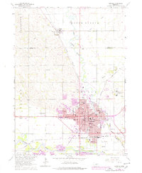
1963 Map of Norfolk
USGS Topo · Published 1964About this map
The Elkhorn River and its various branches anchor the landscape of Madison and Pierce Counties during a period of significant mid-century growth. In Norfolk, a dense urban grid is established, supporting numerous educational and civic institutions including Christian College, Norfolk Jr College, and the sprawling Norfolk State Hospital complex. The city's industrial and logistical importance is evidenced by the intersection of the Chicago and North Western and the Union Pacific railroads, which served the agricultural hinterlands and local facilities like the Mill Bridge Dam.
Find a feature on this map
56 named features on this map. Tap any name to fly to it.
Don’t see what you’re looking for? This feature index may not catch every label — zoom into the map to look around manually.
Map Details
Editions of this 1963 Norfolk Map
2 editions found
Other maps of this area

1955 · Sioux City
USGS Topo · 1:250,000

1955 · Fremont
USGS Topo · 1:250,000

1957 · Fremont
USGS Topo · 1:250,000

1958 · Sioux City
USGS Topo · 1:250,000

1958 · Fremont
USGS Topo · 1:250,000

1959 · Sioux City
USGS Topo · 1:250,000

1963 · Hoskins
USGS Topo · 1:24,000

1963 · Battle Creek
USGS Topo · 1:24,000

1963 · Pierce SE
USGS Topo · 1:24,000

1963 · Wee Town
USGS Topo · 1:24,000
Featured Places
- Norfolk, NE
- Hadar, NE
- Norfolk Mobile Home Community, Norfolk
- Mackels Mobile Home Court, Norfolk
- Madison County, NE