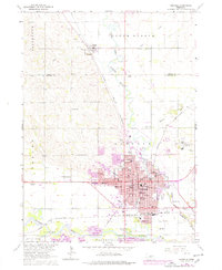
1963 Map of Norfolk
USGS Topo · Published 1977About this map
The Elkhorn River and its South Branch define the geography of Madison County in this mid-century survey, which details the significant growth of Norfolk and its surrounding communities. The map highlights the extensive institutional and educational landscape of the era, from the sprawling grounds of the Norfolk State Hospital to academic centers like Christian College and Norfolk Jr College. The expansion of the city's residential and commercial core is documented through numerous neighborhood schools including Grant Sch, Lincoln Sch, and Jefferson Sch.
Find a feature on this map
63 named features on this map. Tap any name to fly to it.
Don’t see what you’re looking for? This feature index may not catch every label — zoom into the map to look around manually.
Map Details
Editions of this 1963 Norfolk Map
2 editions found
Other maps of this area

1955 · Sioux City
USGS Topo · 1:250,000

1955 · Fremont
USGS Topo · 1:250,000

1957 · Fremont
USGS Topo · 1:250,000

1958 · Sioux City
USGS Topo · 1:250,000

1958 · Fremont
USGS Topo · 1:250,000

1959 · Sioux City
USGS Topo · 1:250,000

1963 · Hoskins
USGS Topo · 1:24,000

1963 · Battle Creek
USGS Topo · 1:24,000

1963 · Pierce SE
USGS Topo · 1:24,000

1963 · Norfolk
USGS Topo · 1:24,000
Featured Places
- Norfolk, NE
- Hadar, NE
- Norfolk Mobile Home Community, Norfolk
- Mackels Mobile Home Court, Norfolk
- Madison County, NE